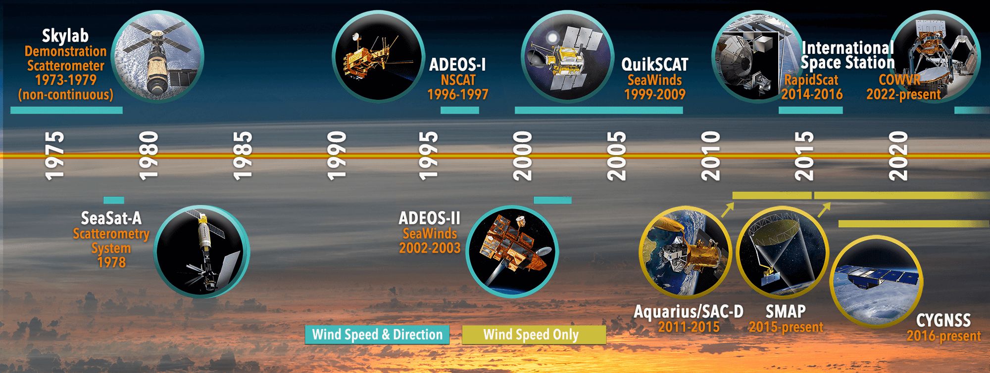
1973-1979
Skylab
In the 1970's NASA launched a series of research-and-development (R&D) satellites. These early pioneers paved the way for today's and tomorrow's observations of our ocean. Rocketing into the 21st century, NASA's Earth-observing fleet grew in size and scope with dedicated ocean satellites observed color (SeaWiFS), sea level (TOPEX, Jason-1), winds (QuikSCAT), and salinity (Aquarius). Additionally, the Moderate-resolution Imaging Spectroradiometer (MODIS) on the Earth Observing System Aqua and Terra satellites observed a comprehensive suite of atmospheric, land, and ocean properties.
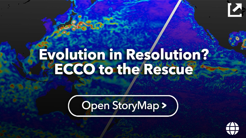
Comparing NASA's fleet in the early 21st century and the current fleet of Earth satellites tells the story of persistence and change. Observations of core ocean properties have been continued an extended into the new fleet with observations at unprecedented resolutions.
Click through the timeline to learn more about the many satellites that have help us learn about our oceans for over half a century.
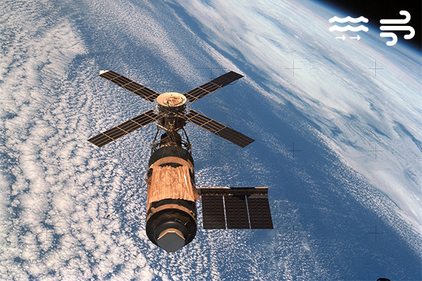
1973-1979
In 1973 and 1974, NASA pushed the boundaries of long-duration human space missions with Skylab, America's first space station. With three crews performing hundreds of science experiments and unprecedented observations of the Earth and the Sun, Skylab laid the foundations for the space science program on the International Space Station and for future missions to the Moon and Mars. Learn More >>
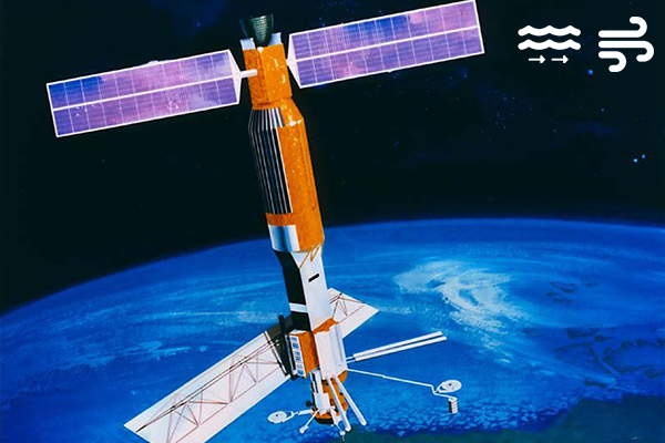
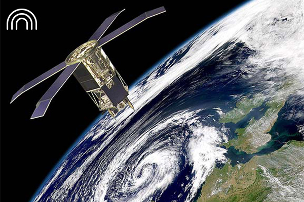
1978
One of the earliest Earth-observing satellites, Seasat was designed to test various oceanographic sensors and gain a better understanding of Earth's seas. It only operated for 110 days but served as a proof of concept for several types of ocean sensors, including those that monitor winds, currents, and sea level. Learn More >>
1978-1995
The Nimbus 7 research-and-development satellite served as a stabilized, earth-oriented platform for the testing of advanced systems used to sense and collect data in the pollution, oceanographic, and meteorological disciplines. It included the Coastal Zone Color Scanner, which proved that ocean color could be measured from space. Learn More >>
1982-1993
andsat satellites have provided over 50 years of earth observations, the first Landsat launched in 1972 and teh most recent (Landsat-9) launched in 2021. Landsat-4 marked a key stepping stone in the program with the addition of the new Thematic Mapper sensor that captured data in seven spectral bands, including a thermal band. This improved spectral resolution allowed its images, for the first time, to be depicted as natural color images. Learn More >>
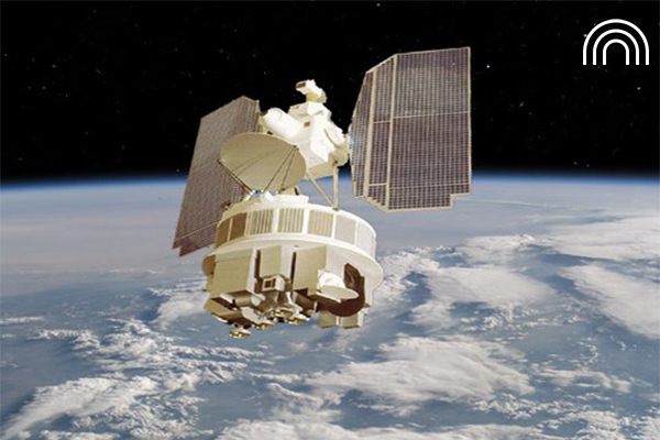
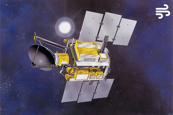
1992-2006
An Earth satellite designed to measure ocean surface topography with unprecedented accuracy, Topex/Poseidon spent 13-plus years in orbit improving understanding of ocean circulation and its impact on global climate. In addition to producing the first global views of seasonal current changes, it enabled scientists to forecast and better understand the El Nino phenomenon of the late 1990s. Learn More >>
1996-1997, 2002-2003
The Advanced Earth Observing Satellite (ADEOS) was the first international space platform dedicated to Earth environmental research developed and managed by the National Space Development Agency of Japan (NASDA). In Japan, ADEOS is called MIDORI. ADEOS I and II both carried instrument s for the measure of wind speed and direction over the ocean. Learn More >>
1997-2010
The Sea-Viewing Wide Field-of-View Sensor (SeaWiFS) designed to collect data on global ocean bio-optical properties, also known as ocean color, launched onboard SeaStar spacecraft in 1997. These ocean color data were critical for the study of phytoplankton production in the ocean and the ocean’s role in the global carbon cycle. Learn More >>
1999-2009
QuikSCAT was designed to be a “quick recovery” EOS satellite mission to fill the gap of global ocean surface wind vector observations. Since launch, however, the SeaWinds instrument provided consistent, high quality data covering more than 90% of the ice-free oceans every day for more than 10 years. Learn More >>

1999-present
The Moderate Resolution Imaging Spectroradiometer (MODIS) measures sea surface temperature, ocean color, and other properties onboard NASA’s Terra and Aqua satellites. Launched in 1999 the Terra satellite houses a suite of instruments explores the connections between Earth’s atmosphere, land, snow and ice, ocean, and energy balance. A few years later the Aqua satellite launched with it’s own suite of instruments focusing on collecting information on the Earth's water cycle as well as other ocean and land properties. Learn More About MODIS | Aqua | Terra >
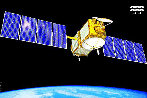
2001-2013
Jason-1 was the first follow-on to the highly successful TOPEX/Poseidon mission, extending ocean surface topography into the 21st century. It helped to increase understanding of ocean circulation, improve forecasting of climate events, measure global sea-level change, and improve coastal tide models. Learn More >>
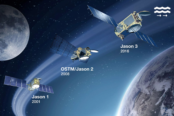
2008-2019, 2016-present
The Jason-2 and Jason-3 satellites further extend the time series of ocean surface topography measurements. These measurements provide scientists with critical information about circulation patterns in the ocean and about both global and regional changes in sea level. Learn More About Jason-2 | Jason-3
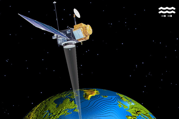
2009-present
The Soil Moisture and Ocean Salinity (SMOS) mission from the European Space Agency (ESA) is the first to provide global observations of both soil moisture and ocean salinity. These observations improve our understanding of the water cycle which is driven by the continuous exchange of water between the oceans, atmosphere and land. Additionally, these observations contribute to better weather, extreme-event and seasonal-climate forecasting. Learn More >>

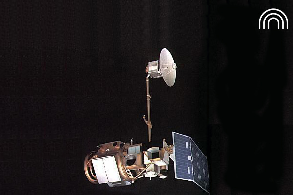
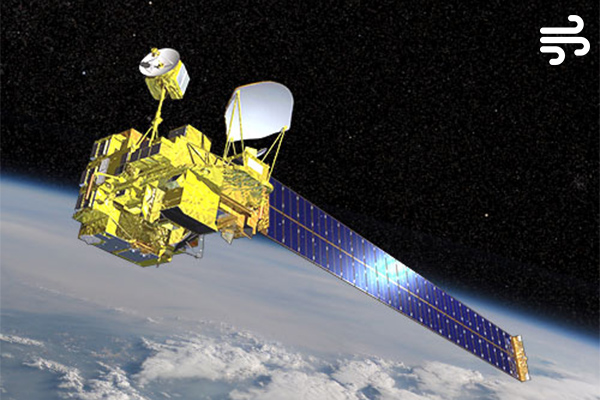
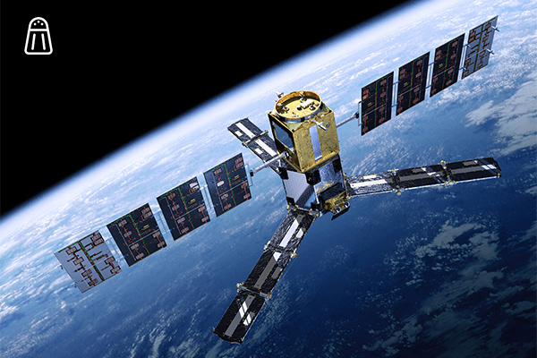
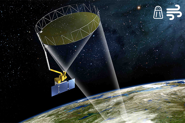
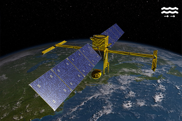
2011-2015
Launched aboard the international Aquarius/Satélite de Aplicaciones Científicas (SAC)-D observatory, Aquarius was NASA's first satellite-based instrument to detect sea surface salinity. It was a pathfinder mission to demonstrate that accurate, scientifically significant measurements of salinity could be made from space. Learn More >>
2011-present
The Visible and Infrared Imager/Radiometer Suite (VIIRS) is a multi-disciplinary instrument that is being flown on the Suomi National Polar-orbiting Partnership (NPP). Expanding on the imaging capabilities of MODIS, the VIIRS empowers operational environmental monitoring and numerical weather forecasting, with 22 imaging and radiometric bands from ultraviolet through the infrared. Suomi is operated by NASA and the National Oceanic and Atmospheric Administration (NOAA). Learn More >>
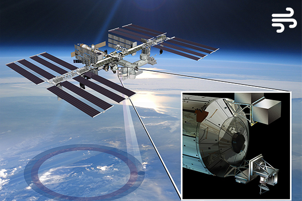
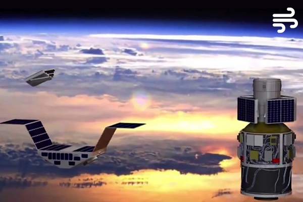
2014-2016
The International Space Station Rapid Scatterometer (ISS-RapidScat) Earth science instrument successfully measured Earth’s ocean surface wind speed and direction over its two-year mission. The unique vantage point of the space station allowed ISS-RapidScat near-real-time monitoring of ocean winds, which are critical in determining regional weather patterns. Learn More >>
2015-present
The Soil Moisture Active Passive (SMAP) mission retrieves soil moisture, salinity, and wind speed data. Launched in 2015, its primary mission is measuring the water content of soil on Earth's surface, helping to improve crop yield forecasts and irrigation planning. However, SMAP data also contributes to the understanding of our ocean by measuring wind speed over the ocean and sea surface salinity. Learn More >>
2016-present
The Cyclone Global Navigation Satellite System (CYGNSS) mission is comprised of eight Low Earth Orbiting spacecraft. Each satellite receives both direct GPS signals and signals reflected from the Earth's surface, together these provide information about the condition of the sea's surface. Sea surface roughness corresponds to wind speed. Learn More >>
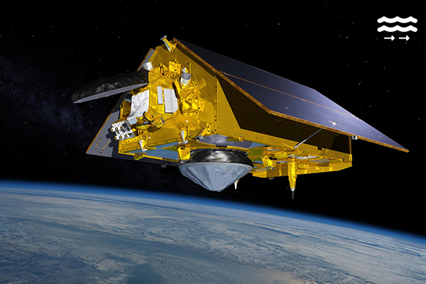
2020-present
Designed to measure the height of the ocean, Sentinel-6/Michael Freilich consists of two identical satellites that will be launched five years apart. Satellite A (Sentinel-6 Michael Freilich) was launched in 2020, Satellite B is planned to launch in 2025. Jason-CS/Sentinel-6 will ensure continuity of sea level observations into a fourth decade. These data will also support improved forecasts of ocean currents, wind, and wave conditions. Learn More >>
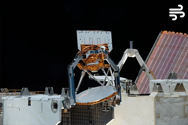
2021-present
The Compact Ocean Wind Vector Radiometer (COWVR) measures wind speed and direction from the International Space Station. No bigger than a minifridge, it is designed to do a big job: to make the same high-quality atmospheric observations as weather satellites many times its size and at a fraction of the cost. If this technology demonstration performs as planned, weather forecasting could be in for a big technological boost. Learn More >>
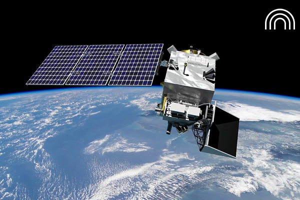
2022-present
Designed to make the first-ever global survey of Earth's surface water, the Surface Water and Ocean Topography (SWOT) satellite collects detailed measurements of how water bodies on Earth change over time. The satellite surveys at least 90% of the globe, studying Earth's lakes, rivers, reservoirs, and ocean with unprecedented resolution in an effort to improve ocean circulation models, and weather and climate predictions, and to aid in freshwater management around the world. Learn More >>
2024-present
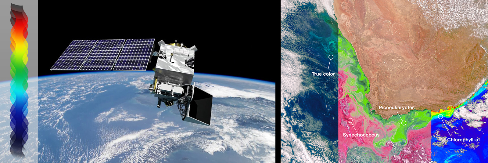
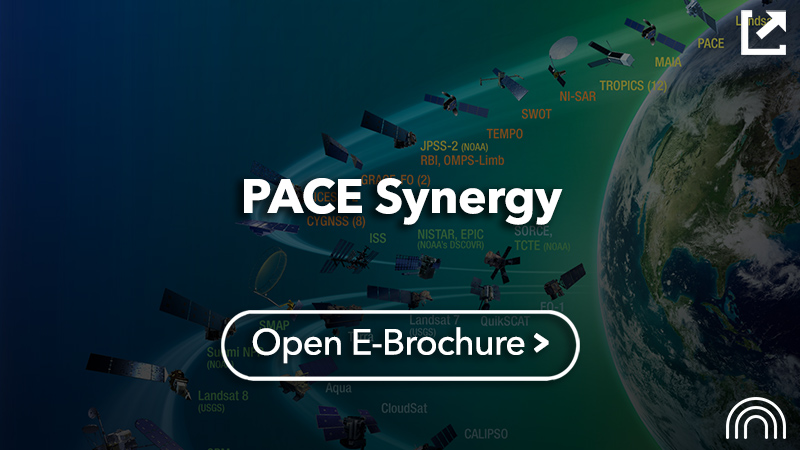
The Plankton, Aerosol, Cloud, ocean Ecosystem (PACE) mission is extending and improving NASA's over 20-year record of satellite observations of global ocean biology, aerosols (tiny particles suspended in the atmosphere), and clouds. It’s primary science instrument, the Ocean Color Instrument (OCI) measures the color of the ocean from ultraviolet to shortwave infrared at a fine scale resolution.Combined with PACE’s has two polarimeters (SPEXone and HARP2) this cutting-edge technology will provide scientists with a view of our ocean in unprecedented detail. Learn More >>


 NASA SALINITY
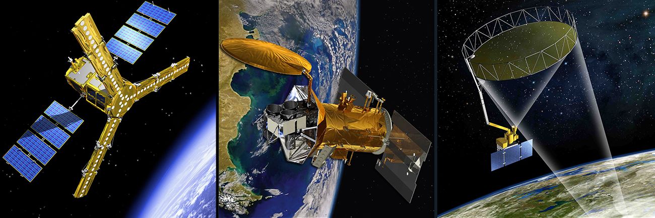
 NASA WINDS